The geology of the area around the orchard
Setting the scene
 There are photographs of the cottages in Donkey Lane from the pre and post WW1 period showing that this was and still is an idyllic setting. It sits at the base of the chalky Chiltern Hills on one of the historic routes in and out of Chinnor.
 Photographic evidence shows that the middle cottage was the only one remaining around 1920 although the top one which was parallel to the lane was still present on a postcard picture, dated, according to the postmark around 1902. The third pair of cottages which were mentioned in the census and depicted on maps disappeared soon after the coming of the railway. They were last mentioned as inhabited on the 1881 census. They are still depicted on the 1880’s map now showing the railway. There is no sign of them on the turn of the century photographs.
The families posing in the above photograph from about the turn of 20th century are wearing their Sunday best and standing close to the railway fence. By this time the bottom pair of cottages had gone, the ladies with the baby would have been standing roughly where they had originally been situated. Today that is near where the new gate into the orchard is situated.
Since the cottages became uninhabited the plot has had several uses. The fruit continued to grow and was harvested every year in the autumn by the locals until present day. It was recollected by some locals that there were berries as well as plums and apples. There are currently plenty of wild blackberry bushes growing but it was mentioned anecdotally that there were still blackcurrants, gooseberries and raspberries still there in the 50’s. These were possibly left over from the kitchen gardens of the cottages or even dumped afterwards by locals as garden waste and rooted.
In the 40’s and 50’s the area was used by the farm workers in the cottages on the village side of the railway to keep their chickens. It has however, largely remained uninhabited and undeveloped now for about a hundred years. It is thought that the last cottage was demolished in the 1920’s. Many people who have recollected about this area describe walking past the orchard up the lane to the hills as a family, often on a Sunday afternoon. Sometimes to the pub on the top of the hill or along to the pubs on the Ridgeway. They all remembered picking fruit on the way back.


In December 2022 during the first archaeological dig in the orchard with The South Oxfordshire Archaeology Group (SOAG), it became obvious that in some places, approximately 40 centimetres below the soil cover was a solid chalk base with occasional flints. This is an ideal situation for springs in the chalk. There were many of these in Chinnor making it an ideal place for a settlement. There are records of settlements in Chinnor since at least Saxon times and wells being dug for new housing right up until the houses were built in Lime Grove, near the church in 1932.

The Parish Council of the time were resistant to mains water being brought to Chinnor right up to 1950’s because of the abundance of ‘lovely chalk springs’ that were present in the area. However, there was a growing concern by the Women’s Institute that there were higher than average cases of gastric related illnesses in the area. Fiona Mantle’s PhD study, The Social History of Medical Self-Help in 20th-Century England: A Microhistory of a Rural Community talks at length about the problems and mentions sanitation.
On checking the water quality, it was discovered that an amount of seepage from agricultural sites was polluting the supply and causing illness in the population. Fiona says in her Sanitation section; “There was no piped water or main drainage in Chinnor until after the Second World War and villagers had to rely on spring water pumped from wells. Just into the 20th century an open drain flowed down the high street and was thought to be the cause of many illnesses (there was a smallpox outbreak in 1904.)”. It was decided that something must be done to prevent this and in 1952 mains water was brought to Chinnor.

The original plan for this still exists and has the proposed route of the water mains marked on it. The water main stopped in Keens Lane between the horse chestnut tree and the railway but did not go to the old houses that were still in the field belonging to Hill Farm.
The end of this main is where the nearest standpipe is for the Donkey Lane Community Orchard emergency plan. Because they were unable to get planning permission to update the old houses by installing mains water and drainage, the Eggleton family had two new houses built to replace the 17th century houses. These new houses had running water, new bathrooms, drainage and a downstairs toilet in a ‘boot room’ which also contained a large copper for boiling water. The copper was still in situ in the early 1980s. These houses were built on what was described as the ‘Workhouse Yard’ on the pre-enclosure map, marked with the number 6.

The last occupants were Derek and Mabel Howlett and Mabel’s daughter Valerie and Sydney and Doris Heybourne and their children Jean and Joan. They moved into the two new houses over the lane in about 1955. Val remembers going over to excitedly use the fancy bathroom in the new house before they had properly moved in.
It was noted by Val Wells that Doris Heybourne was reluctant to move all her things out of the house into the new one. Doris got very irate when a passing walker, Lillian Morby, thought the house was abandoned and helped herself to some net curtains that she thought were going to waste. Doris chased her down the road to get them back. Lillian recollected this story and passed it on to us through her daughter Julie. Lillian, Julie and her brother Michael are descendants of the Rogers family who were amongst the last occupants of the Orchard cottages in the early 20th century. The details of this story are amongst many delightful anecdotes reported to us by ‘Chinnorites’ from their living memories of the immediate area.
Geological make up

The chalk escarpment of the Chiltern Hills overlooks the Vale of Aylesbury. The Chiltern Hills are part of a system of chalk downlands throughout eastern and southern England, formed between 65 and 95 million years ago. A phase of deformation tilted the chalk layers in the area of the Chiltern Hills forming an escarpment. Chalk hills, known as chalk downland, usually form where bands of chalk reach the surface at an angle, so forming a scarp slope. Chalk has greater resistance to weathering and slumping than the clays with which it is usually associated. The chalk strata are frequently interspersed with layers of flint nodules which apparently replaced chalk and infilled pore spaces. Flint has been mined for thousands of years from the Chiltern Hills. They were first extracted for making flint axes and other tools in the Neolithic period, then for knapping into flintlocks. Nodules are also to be seen everywhere in the older houses as a construction material for walls and often in this area dug up in the garden. Because chalk is porous it can hold a large volume of ground water, providing a natural reservoir that releases water slowly through dry seasons.
Local effects
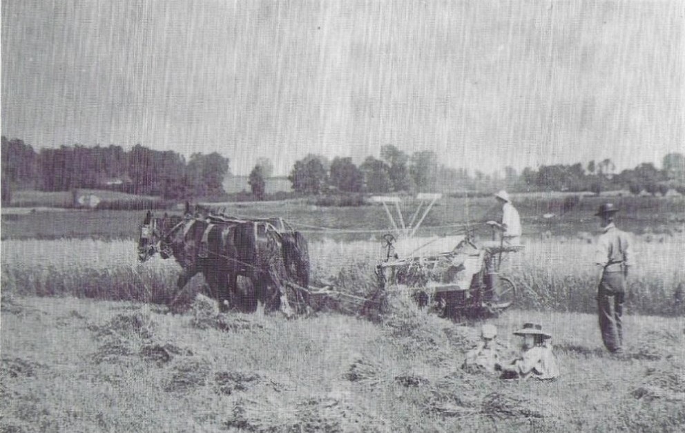
There are many springs along the bottom of the hill. Digging into chalk provides ideal sites for deep wells as found in the orchard and Hill Farm. The turquoise-coloured strip on the map is the clay which is impermeable and causes water to puddle, mostly in the winter, and not easily drain away, hence the regular flooding towards Thame. In the summer these flooded areas are very fertile and produce good crops.Chalk is very porous and allows water to seep through and gather like a giant sponge and with heavy rainfall the chalk becomes saturated. The water table then rises and run off water causes puddling at the bottom of the hill. Water held in the chalk can be tapped into as wells. This is illustrated very clearly in the orchard well where it has been dug out to make a den showing the very firm, chalky sides. The clay illustrated on the map shows the damp marshy areas between Chinnor and Thame that were very fertile in the summer, particularly good for growing cereal crops producing a suitably high-quality straw. This straw was popular with the Luton Milliners at a time when the Napoleonic wars prevented them from getting their favoured and more superior Tuscan straw.
The straw plaiting industry began in Luton and the surrounding areas in the mid-17th century and gradually increased in importance as straw hats became widely popular. After imported plaits from Italy were unavailable during the Napoleonic wars (1803-1815), straw grown from the Chiltern area was more commonly used. The import of foreign, ready-made, plaits in the 1870s and 80s led to the collapse of the British plaiting industry although the hat industry continued to thrive. We are unsure how much plaiting took place in Chinnor. Towards the end of the century the straw supply to the hatters from Chinnor reduced.
Effects of the weather
When it rains heavily the roads in and out of Chinnor still have regular points for flooding that are situated when the land levels out and begins to become the plain. Water runs down the made lane known as Donkey Lane and on down the High Street during and after heavy rain. It does not readily sink into the top layer and runs on down the metaled surface of the High Street, puddling beside the Red Lion. It seems to bypass the drains set at the side of the road, flowing down the middle. Earlier we mentioned that there had originally been an open sewer down the middle of the High Street in the early 20th century. After very heavy rain the water going into the drains can lift the man-hole covers up with some force creating small water fountains on the pavement which then run on down the street to the bottom, where it still causes flooding on the Lower Road. Until the 70’s there was a pond at the bottom of the High Street on the corner, opposite the Red Lion and another about half way down the High Street. These have both now gone and no longer provide a place for surface water to run off, which may have had an impact on present day flooding. Recently this water had frozen hard making the High Street treacherous for a few days. There are several more places in the village that are regular sites of flooding these are mostly where the land levels off causing the water to puddle. Interestingly these sites are mostly outside the village pubs!What we have learned from photographs

These photos, courtesy of Eddie Heybourne, show Donkey Lane prior to the hedge becoming such a big feature. These are more than likely post WW2. In the background it is clearly a lot less wooded up on the hill. In this picture you can just see the chimneys of Stepping Hill and the pale front of Greenway which was built in 1930s.
An even earlier view of the hills from just beside the cottages. A very agricultural scene from a postcard from Lings shop, postmarked in March 1908. Westdown and the Horseshoe can be seen top right. The hillside was a lot clearer of vegetation then. Local views were commonly photographed and made into postcards for sale in shops and post offices. Ling’s on the corner of Keens Lane, later Brazell’s were local sources of these cards. Many of these cards are in local collections and are a great source of historical information.

There were shepherds noted on the census in one of the Hill Farm Cottages between 1851 -1871. In 1851, William White, in 1861, Thomas and son John King and in 1871 John Rogers. It would seem that there was no designated shepherd after that although the shepherd’s cottage was still occupied by agricultural labourers. The sheep in the picture in 1908 perhaps still grazed the chalk grassland on the hill. They certainly look well fed. The next picture is a similar view in 2020. The fields are now very open and the whole area is cultivated.

The geology has had a significant influence on many crafts that are carried out and industries using the raw materials that are found here. It also supports chalk loving flowers and insects in abundance. Including certain varieties of wild orchids and butterflies found mostly in chalky areas.
Flora and fauna


Above are some of the flowers growing on the chalk on the Chilterns at Chinnor including, the beautiful bee orchid, common spotted orchid, primroses and oriental poppies. There are many more chalk loving species. (photographs, C. Stewart) The Chilterns are well known for their beautiful bluebells which have attracted visitors for years. These mostly grow in the clay patches, not on the chalk.

There are a vast number of well labelled pathways to choose to walk, run, cycle or ride and offer a choice of intensity and distance to suit almost everyone.
It has appeared to have been used by more people during the lockdown in 2020/21 than in recent years. Not just dog walkers, mountain bikers, riders and runners but many more people walking. Those who during the normal working week may not have had time and people seeking a quiet place to walk whilst safely, socially distancing. Fortunately, it stayed dry for most of the lockdowns and walking was quite easy going and rarely slippery.
Unfortunately, the top coating of clay makes it very heavy going when it is wet and becomes very slippery. It makes you think of the workers who had to use it in days gone by in order to make a living and did not have any choice but to slip about on the greasy surface. It is probable, if they were lucky, that they would be wearing hob-nail boots which would give them better grip. However, they would still need to carry heavy loads if they did not have the luxury of a donkey or horse. Most of their firewood and sometimes timber for construction will have been collected from the wooded parts of the hill. This would have been especially hard work in the winter when it was very slippery.
 This photograph taken from the Ridgeway path looking down towards the village illustrate how chalky the bedrock is. The surface soil has been washed away here leaving chalk and flint on the surface. Where the hedge looks thicker further down is where it can puddle and makes glutinous, sticky puddles that could suck your wellies off. According to the British Geological Survey maps there is a strip of clay, silt, sand and gravel which crosses the lane here and explains the stickiness. some of It has improved in recent years as there has been rubble dumped in the wettest parts making it firmer although still treacherous at times.
It has appeared to have been used by more people during the lockdown in 2020/21 than in recent years. Not just dog walkers, mountain bikers, riders and runners but many more people walking. Those who during the normal working week may not have had time and people seeking a quiet place to walk whilst safely, socially distancing. Fortunately, it stayed dry for most of the lockdowns and walking was quite easy going and rarely slippery.
Unfortunately, the top coating of clay makes it very heavy going when it is wet and becomes very slippery. It makes you think of the workers who had to use it in days gone by in order to make a living and did not have any choice but to slip about on the greasy surface. It is probable, if they were lucky, that they would be wearing hob-nail boots which would give them better grip. However, they would still need to carry heavy loads if they did not have the luxury of a donkey or horse. Most of their firewood and sometimes timber for construction will have been collected from the wooded parts of the hill. This would have been especially hard work in the winter when it was very slippery.

In 1988 our children, and some friends staying with us, collected some of the clay from one of the deeper puddles in Donkey Lane and made pots with it, letting it dry in the sun. These held together quite well. As it is now a more popular dog walking area it would not be advisable or hygienic to try it!
During the dig in December 2022 in the test pit nearest the lane, revealed the bottom of a structure. This appeared to be made from lime mortar and flint. This is highly likely because there is an abundance of the raw materials in this area. What we first thought to be chalk seemed a little more granular than chalk and the experts from SOAG immediately identified it as lime mortar. It filled the gaps between flints which we hope is the base of one of the buildings.

We hope to be able to extend the dig in the future.
The local geology has been instrumental in the shaping of the industry in the area around Chinnor. The major employment for many years was agriculture, topped up by lacemaking, bodgers for the chair industry and woodsmen. With the coming of the railway opportunities expanded. Goods could be easily and quickly transported out and materials brought in.
Growing Heavy Industry
In 1908, while at least 2 pairs of the cottages were still standing in the Orchard, Mr William Elijah Benton, a mining engineer from Acton in West London, bought some land in Chinnor. He founded a small business to manufacture lime on the southern side of Chinnor. This was at the base of Chinnor Hill a few fields away from the orchard along the railway line. Most of Chinnor lies in the Lower Chalk belt at a height of between about 300 feet to 400 feet and is good arable land. At the southern end, where the ground rises steeply from 500 feet to 800 feet, there is a belt of Middle Chalk and of poorer soil. This was an ideal location for the original lime works. William Benton established his original works with five Beehive Lime Kilns which produced lump lime which was used in agriculture as a fertiliser and in construction as lime mortar as a bonding agent.Agricultural lime
There are many benefits to spreading lime on farm land. Lime is a soil conditioner and controls the soil acidity by neutralising the effects of acids, slurry and high rainfall. Other benefits include an increase in earthworm activity, improvement in soil structure and grass is more palatable to livestock. Agricultural lime is limestone that has been crushed down to very tiny particles and heated in kilns to a very high temperature. The material must be crushed very finely in order to have a positive impact on soil. In fact, the smaller the particle size of the agricultural lime, the more effective it will be.
The Lime Works became a Cement works in 1921and underwent much modernisation. The left-hand picture above picture shows the site of the Cement works in 1930s after it was redeveloped from the Lime works but before the quarries were extended onto the other side of the Ridgeway. The new kilns are in the foreground, but the original beehive kilns can be seen on the left-hand side of the quarry. One of these is still in position now in amongst the new houses on the Kiln Lakes development. The layers of chalk can still be clearly seen in the walls of the quarry. This photograph was taken in 2020 during the lockdown. There are many full accounts available of the development of this site via;- www.chinnorrailway.co.uk and www.chinnorheritage.org.uk .
Lime mortar is composed of lime, water and an aggregate such as sand. Lime mortar today is primarily used in the conservation of existing old buildings or the recreation of new ones using traditional methods. Its use dates back at least 6,000 years, to the Ancient Egyptians who used lime to plaster the pyramids. With the introduction of Portland cement during the 19th century, the use of lime mortar gradually declined. However, the soft and porous properties of lime mortar provide certain advantages when working with softer building materials such as natural stone and terracotta. While Portland cement continues to be commonly used in new constructions of brick and concrete, it is not recommended in the repair and restoration of brick and stone-built structures originally built using lime mortar. Lime mortar is more porous than cement mortars, and it wicks any dampness in the wall to the surface where it evaporates. Any salt content in the water crystallises on the lime, damaging the lime and thus saving the masonry.
Limewash There are many further useful applications for by-products of chalk, limewash is one of these. It was often used to paint houses both inside and out for several very practical reasons. In the photographs we have of the cottages, at least the top pair were painted white. It is most likely they would have been whitewashed inside too. Any beams were more likely to be painted with limewash than the more recent fashion to pick them out in black gloss paint!
Lime Wash can be identified in Roman construction and its use is clearly visible in the Pompeii and Herculaneum ruins in Southern Italy. Lime Wash reached its height of popularity during the Renaissance and continued as the masonry paint of choice until after WWI, then almost disappearing from mass production by the late 1950s except for outhouses and more remote farm buildings. This was replaced by a more popular product more commonly known as ‘whitewash’ which lacked a lot of the chemical benefits of lime wash.
The process to make proper lime wash is more time consuming and expensive than the much cheaper whitewash.
The sedimentary chalk is crushed and then placed into very hot ovens (kilns) for 1 to 2 days. In this phase a reaction occurs, reducing the weight of the stone by a 1/3rd as a result of the loss of carbon and oxygen. This is called Active Lime, and for the final phase of this material to be used in plaster and paint, it must be deposited in pools where water can be added slowly over 2 years, during which time intense heat is generated through a chemical reaction. Quite a lengthy process.
Limewash is a fire retardant, antiseptic, antifungal, odourless and non-allergic paint, it can slow deterioration of wood and brick due to weather and allow rainwater to run down the outside walls without soaking in. It helps buildings "breathe" by allowing trapped moisture to pass out of the building, reducing mildew and rotting of structural timbers.
It can also eliminate larvae, reduce odours where animals are kept and when painted on roofs it reduces inside temperatures up to 10 degrees. Useful to paint on greenhouse windows to prevent scorching the plants inside in hot weather. It also sweetens the soil around a building. All these benefits will have helped the old houses last as long as they did if they were limewashed both inside and out.
Limewash on iron or other metals prevents rust. Painted on tree trunks, limewash prevents disease, sunburn or frost injury. Very useful stuff.
According to ‘Unity Lime Products’, ‘despite its enduring utility over many centuries, lime mortar’s effectiveness as a building material has maintained an air of mystery. Only during the last few decades has testing provided a scientific understanding of its remarkable durability. Previously time-honoured practices were based on local tradition, folklore and trade knowledge, vindicated by the vast number of old buildings that remain standing.’
There are other sites along the line of chalk in the Chilterns that produced lime-based products such as Pitstone near Tring and Westbury in Wiltshire. The industry is a very important one to the whole country but restricted by the location of the raw materials. Chinnor and the chalk escarpment was a very significant area in the production of lime.
The Beech Tree
Another example of the geology contributing to the activity in the vicinity is the growth of the beech tree, the Queen of British trees (as the oak is the king). The natural habitat of the beech tree extends over a large part of Europe from southern Sweden to northern Sicily. It requires a humid atmosphere and well-drained soil and it can be sensitive to winter frost. In the UK, common beech is only considered truly native to south-east England and south-east Wales. It grows in woods or as single trees, usually on drier, free-draining soils, such as chalk, limestone and light loams. The Chiltern escarpment offers a very suitable habitat with plenty of chalk and excellent drainage and consequently there are many beech trees locally. The beech tree has a shallow root system that spreads out rather than down and is often susceptible to being toppled in high winds on the chalky escarpments. Mature trees grow to a height of more than 40m and develop a huge domed crown. The bark is smooth, thin and grey, often with slight horizontal etchings. The reddish brown, torpedo-shaped leaf buds form on short stalks and have a distinctive criss-cross pattern. The benefits of beech trees are many, their habit of growing straight and tall makes them ideal for all sorts of construction as well as fuel. Beech trees were extensively planted in the Chilterns in the late 18th century.
Furniture trade and wood
Beech timber is suitable for a variety of purposes, including fuel, furniture, cooking utensils, tool handles and sports equipment. The wood burns very well. It is plentiful in the local area and key to the local furniture industry providing much needed work for bodgers who turned chair legs for the furniture trade in High Wycombe. Some worked at their homes in the village and others setting up pole lathes in situ in the woods up on Chinnor Hill. This was mostly during the winter months when agricultural labour was sparse. Some set up homemade shelters and stayed up there while they worked although it must have been very cold. In order to make a living as a bodger it was necessary to turn at least 144 chair legs a day. Before they could make the legs, they needed to cut suitable sized pieces of wood in order to shape into the chair legs, these are called billets. The billets are then shaped on the pole lathes into chair legs.
The beech tree was also thought to have medicinal properties and its leaves were boiled to make a poultice which was used to relieve swellings. Forked beech twigs are also traditionally used for divining.
Prior to the growth of the furniture trade there was a huge trade in firewood in the Chilterns, including supplying as far away as London although this reduced dramatically with the growing use of coal as fuel. There was a ‘wood dealer’ living in the orchard cottages in 1851 census, John Guntrip. There was little space for storage of large timber in the immediate vicinity so perhaps he may have been dealing in firewood although as yet we have no hard evidence of him trading in firewood.
In the previous census of 1841, he was described as a woodsman and by 1851, a wood dealer. Similarly, his wife was described as a lace maker in 1841 and as a lace dealer in 1851. As the lane was known as Guntrip lane at this time. They would seem to be an enterprising pair, making the most of the resources of the local area. Sarah’s mother, Mary Gomme lived with them in 1841 and was also described as a lace maker but at this time was 80 years old. We think that they lived in the bottom cottages nearest the railway line which were demolished first. It would be interesting to know if the railway was in any way responsible for that or whether they had simply fallen into disrepair.
It is not known yet when any of the cottages were built or even which was built first. The two we have photographs of were of very different construction. The middle cottage that remained the longest looks to be of brick construction with a thatched roof and was still there in 1920. We have not yet found it on the 1921 census, so we are unclear whether it was still occupied then. The top cottage parallel to the lane seemed to have been demolished between 1901 and 1911. This cottage had a tiled roof and was very likely to have been of wattle and daub or the more local wichert construction.
Wichert was a traditional way of building in the Vale of Aylesbury, particularly Haddenham, using the lime rich soil mixed with chopped straw.
Wikipedia tells us; Wychert or wichert (with a number of variant spellings existing and meaning "white earth") is a natural blend of white chalk and clay which is mixed with straw to make walls and buildings, usually then thatched or topped with red clay tiles. This historic method of building construction is localised to Haddenham and the surrounding local area in Buckinghamshire. One of the largest known wychert structures is Haddenham Methodist Church.
The method of building with wychert is similar to that of a cob building. To maintain the rigid nature of wychert it must not become too dry for risk of crumbling, nor too wet for risk of turning to a slime. Keeping wychert well ventilated and not subject to excess condensation is therefore highly recommended. Any render applied to a wychert wall must therefore be of a breathable material — rendering wychert walls with a lime based render is therefore common practice.
This was taken from Wikipedia. Please note that one of the largest known wichert structures is actually the Baptist Church in Haddenham which is currently running an appeal for ‘Hat and Boots’ renovation to preserve the wichert construction which has suffered some water ingression causing some serious damage to the structure.

In these days of mains water and largely mains drainage it is hard to understand how difficult it must have been to have enough water and what you would have to do when the well was frozen in the winter. The porous nature of the chalk and the slow release of the water would make it less likely for the wells to dry up in protracted periods of dry weather. The other benefit of the chalk would provide very clean, clear water if there were no pollutants draining into it. Pollutants would have increased as industry and agriculture became more intensive with the Agrarian and Industrial revolution which intensified in the 18th/ 19th century.
Life was clearly more physical for everyone who had to fetch their water instead of just turning on a tap. This was illustrated by Mabel Howlett who counted 30 buckets of water from the well on one of her washing days. Looking at the number of wells on the map (there may have been more) in the vicinity of the orchard the water would have been near to most homes. Chinnor still had a ‘night soil man’ into 1940/50s, within the living memory of some current Chinnor residents. The last one was known as ‘Doggy Crooks’ who dumped his collections in a pit in Keens Lane at the back of the outhouses belonging to The Old Workhouse building.
There will be many more ways in which the local geology enhanced the lives of the people living here when times were harder but based on the examples here it would seem that it was not too bad a place to live even when times were very trying.
Carol Stewart, Orchard Story Group January 2023
It is not known yet when any of the cottages were built or even which was built first. The two we have photographs of were of very different construction. The middle cottage that remained the longest looks to be of brick construction with a thatched roof and was still there in 1920. We have not yet found it on the 1921 census, so we are unclear whether it was still occupied then. The top cottage parallel to the lane seemed to have been demolished between 1901 and 1911. This cottage had a tiled roof and was very likely to have been of wattle and daub or the more local wichert construction.
Wichert was a traditional way of building in the Vale of Aylesbury, particularly Haddenham, using the lime rich soil mixed with chopped straw.
Wikipedia tells us; Wychert or wichert (with a number of variant spellings existing and meaning "white earth") is a natural blend of white chalk and clay which is mixed with straw to make walls and buildings, usually then thatched or topped with red clay tiles. This historic method of building construction is localised to Haddenham and the surrounding local area in Buckinghamshire. One of the largest known wychert structures is Haddenham Methodist Church.
The method of building with wychert is similar to that of a cob building. To maintain the rigid nature of wychert it must not become too dry for risk of crumbling, nor too wet for risk of turning to a slime. Keeping wychert well ventilated and not subject to excess condensation is therefore highly recommended. Any render applied to a wychert wall must therefore be of a breathable material — rendering wychert walls with a lime based render is therefore common practice.
This was taken from Wikipedia. Please note that one of the largest known wichert structures is actually the Baptist Church in Haddenham which is currently running an appeal for ‘Hat and Boots’ renovation to preserve the wichert construction which has suffered some water ingression causing some serious damage to the structure.
Wells nearest to the Orchard
The map below shows the position of the wells in the immediate area of the orchard. As this was taken from an old map there may have been more wells in this area than are obvious.
In these days of mains water and largely mains drainage it is hard to understand how difficult it must have been to have enough water and what you would have to do when the well was frozen in the winter. The porous nature of the chalk and the slow release of the water would make it less likely for the wells to dry up in protracted periods of dry weather. The other benefit of the chalk would provide very clean, clear water if there were no pollutants draining into it. Pollutants would have increased as industry and agriculture became more intensive with the Agrarian and Industrial revolution which intensified in the 18th/ 19th century.
Life was clearly more physical for everyone who had to fetch their water instead of just turning on a tap. This was illustrated by Mabel Howlett who counted 30 buckets of water from the well on one of her washing days. Looking at the number of wells on the map (there may have been more) in the vicinity of the orchard the water would have been near to most homes. Chinnor still had a ‘night soil man’ into 1940/50s, within the living memory of some current Chinnor residents. The last one was known as ‘Doggy Crooks’ who dumped his collections in a pit in Keens Lane at the back of the outhouses belonging to The Old Workhouse building.
There will be many more ways in which the local geology enhanced the lives of the people living here when times were harder but based on the examples here it would seem that it was not too bad a place to live even when times were very trying.
Carol Stewart, Orchard Story Group January 2023
If you would like to know more about the Donkey Lane Community Orchard project or get involved, please contact Linda on 07973 788993 or email greeningchinnor@gmail.com.
Back to Stories
Works and memories cited
Fiona Mantle PhD study, The Social History of Medical Self-Help in 20th-Century England: A Microhistory of a Rural Community (Sanitation)British Geological Survey www.bgs.ac.uk
Unity Lime Products, York. (Lime wash, Lime mortar)
Chinnor in Camera (Page 40)
The Woodland Trust (Beech trees)
The Chiltern Society (the work of bodgers)
Chinnor Heritage (cement works) https://www.chinnorheritage.org.uk/
Chinnor Railway (Lime works) https://www.chinnorrailway.co.uk/
Victoria County History - Oxfordshire A History of the County of Oxford: Volume 8, Lewknor and Pyrton Hundreds Parishes: Chinnor https://www.british-history.ac.uk/vch/oxon/vol8
Wikipedia, “wychert”
Chiltern AONB www.chilternsaonb.org
Haddenham cum Dinton Baptist Church www.haddenhamcumdintonbaptistchurch.com
Valerie Wells and her mother Mabel Howlett’s memoirs.
Lillian and Michael Morby and Julie Slaymaker, descendants of the Rogers family.
No comments:
Post a Comment